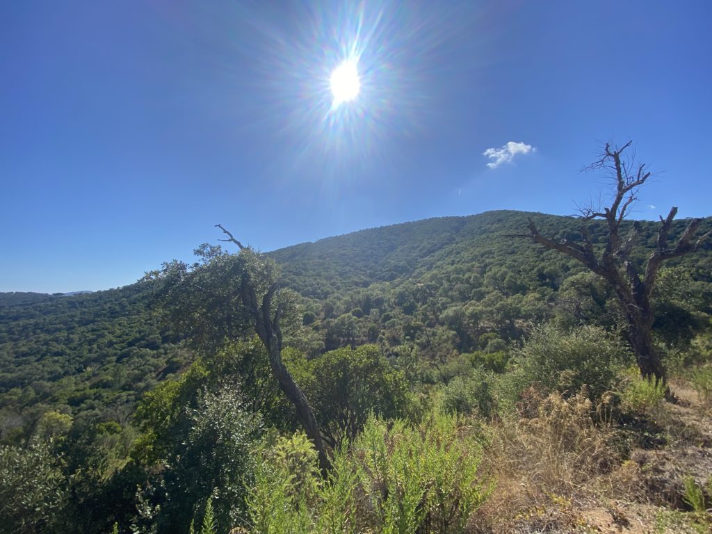
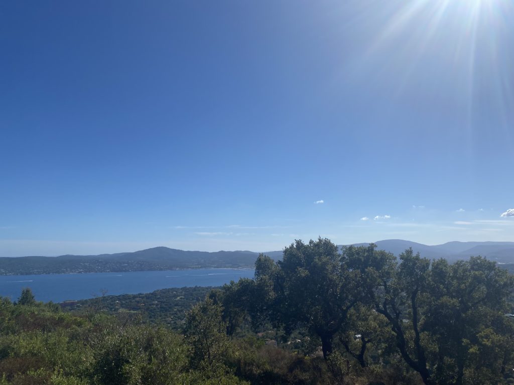
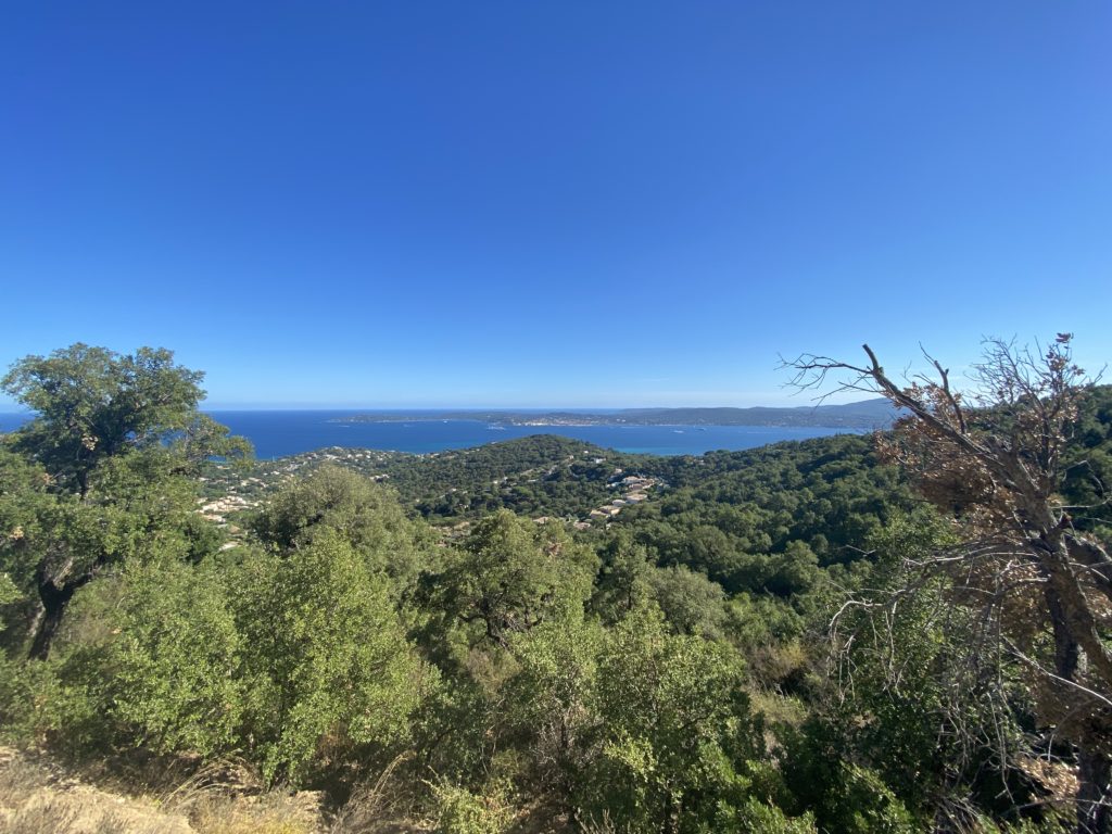
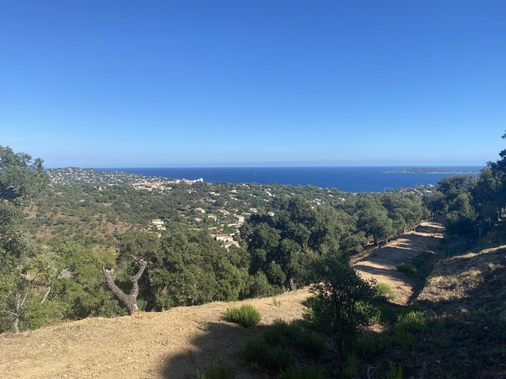
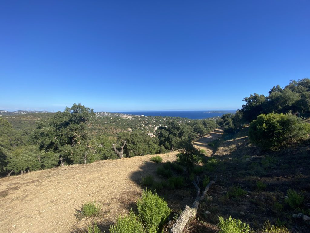
This has become a staple run for me ever since we started to come to Sainte-Maxime. I was having cell reception issues but was frustrated because I could see a tower in the low forested hill behind the complex we were staying in. Looking at some maps I noticed that the area was laced with fire roads and perfect for running. The only problem is if it was accessible. In this part of France they take their private property seriously and there are gates blocking just about every community. Unlike in the States where you’d have a public road then a gated community off to the side, these gates usually block main roads so you can’t even get past a certain area. It’s frustrating but usually circumventable if on foot (ie, the pedestrian gate is often unlocked).
Directions to the trailhead – You will want to turn up the hill on Av. du Souvenir Français (the St Max Tennis Club) and head up the hill. One good option is to park at the Cemetery (29 Av. du Souvenir Français, 83120 Sainte-Maxime) in which case you’d only have one gate to get through (and that at this point you can just walk around if it’s closed).
Through the gate you’ll walk to the bottom of the hill and keep going straight rather than turning left and crossing a small bridge. You’ll need to go around an armed gate to what looks like an abandoned entrance to another domain. Follow that until you come to a cul-de-sac. Go up that road a short time and turn left at the next road. You’ll be in another residential area. Follow that road and it will terminate in a housing development that was never built (it has graded plots, paved roads and other infrastructure but no housing. Note that there are other (probably easier) ways to access the fire roads – this is simply the closest from our residence.
Here are the stats:
- Distance: 8.10km
- Moving Time: 1:08:45
- Pace: 8:29/km
- Elevation: 273m
- Calories: 1,058
- Elapsed Time: 1:31:04
- Partly Cloudy
- Temperature: 76 ℉
- Humidity: 56% Feels like: 76 ℉
- Wind Speed: 24.3 km/h
- Wind Direction: E
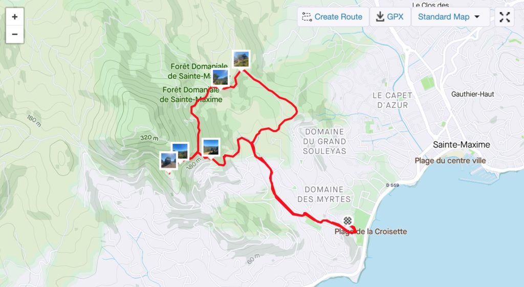
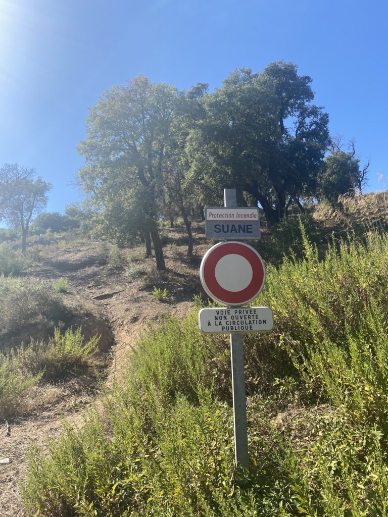
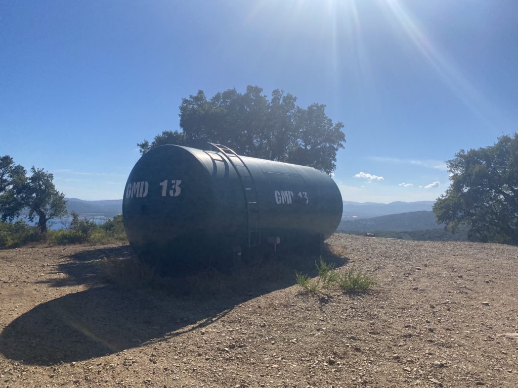
The start of this run is the same as the Cell Tower portion posted here. Once you get to the tower, continue towards the direction of the hill along a small singletrack section. This will drop you onto Chemine du Suane at the bottom of a small climb. This is a paved road covered with gravel. At the top of that hill, turn left (straight ahead is a private residence and to the slight left is a Sainte-Maxime water treatment facility that is difficult to see from the road). Note that the fire roads are active roads – there isn’t much traffic but people do drive in and out – both officials and residents.